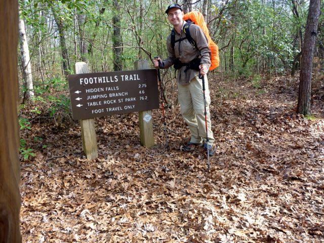
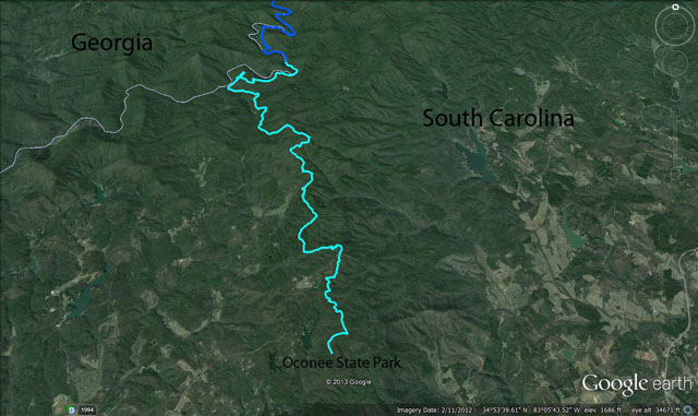
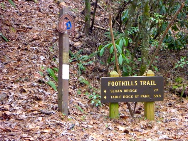
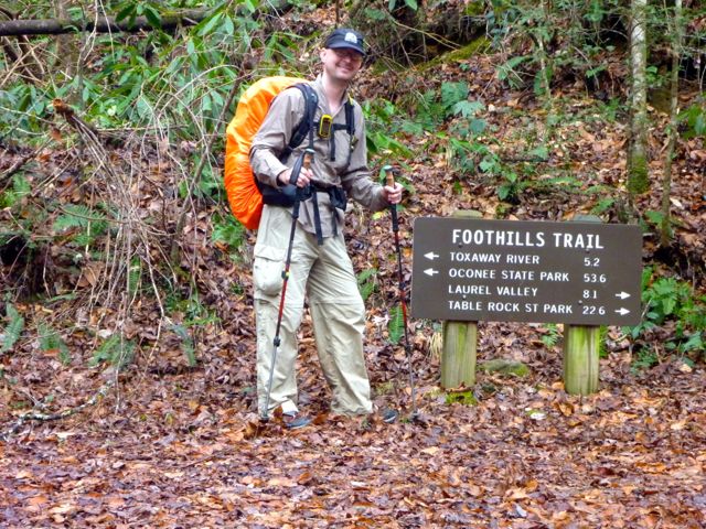
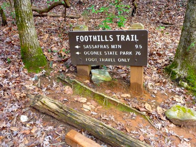
The Foothills Trail trailhead at Oconee State Park, South Carolina
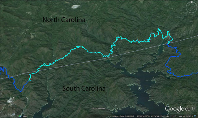
I've heard nothing but good things about this 77 mile trail that runs along the border of South Carolina and North Carolina. I had posted the trip on the DC Ultra-Light Meetup group that I've been backpacking with but got no takers given the awkward timing between Christmas and New Years. I went down and ended up backpacking it as a solo trip. A solo trip is new to me so this was an experience! I went overkill on the self-support with the map, compass, guidebook, and Garmin eTrex (GPS) with a preloaded map/waypoints. As it turns out the trail was so easy to follow I never did crack any of them open other than to log my own track and way points or review the day while snuggled in my tent.
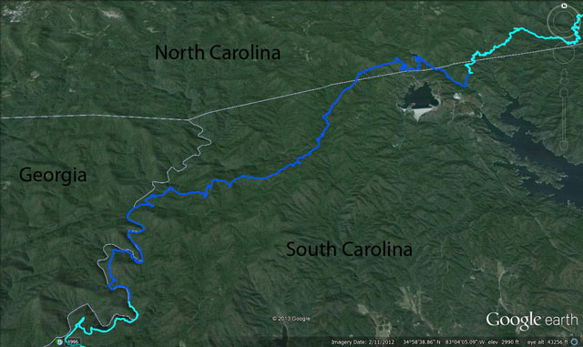
Summary: 5 days door to door with splits of 11, 22, 18, 23, 5 (with travel to/from on the first/last day).
A possible complication was that I'd had a lousy performance in the Seashore Nature Trail 50K run the weekend before where my right inner knee was giving me grief. I strongly suspect muscle fatigue due to lack of well-balanced training. It flared up about 16 miles in and forced me to slow to a walk the rest of the race for my personal worst on the course. It's too bad as I was on track for a great time. Oh well. After a couple days I didn't feel any issues while walking so I figured I was good to go. There's a happy ending there at least. It didn't bother me in the least during the hike.
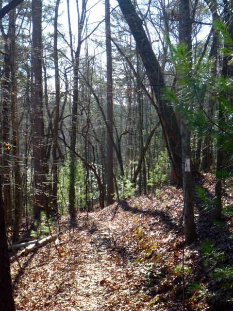
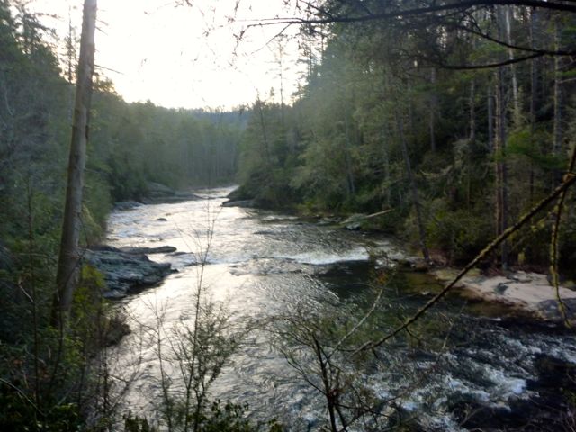
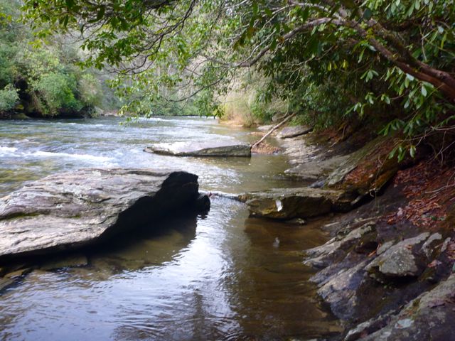
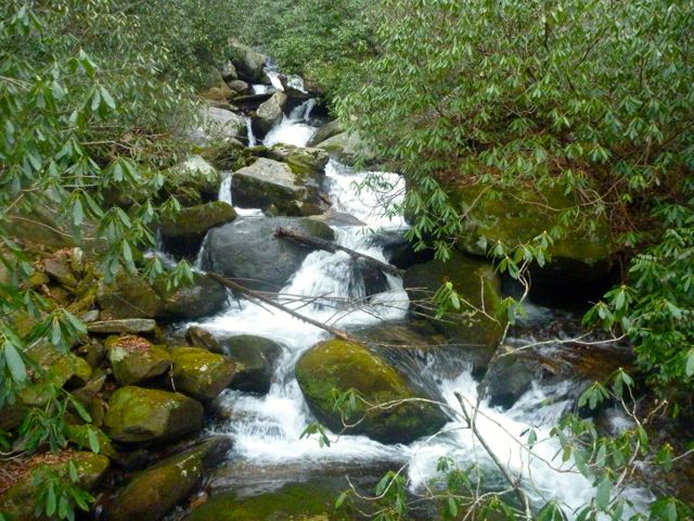
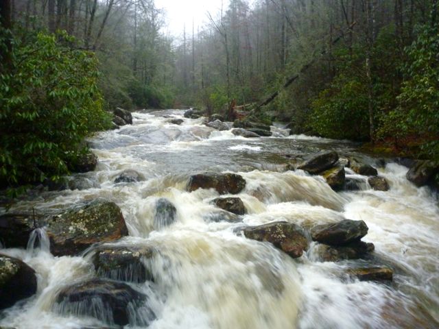
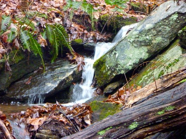
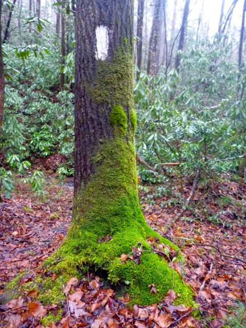
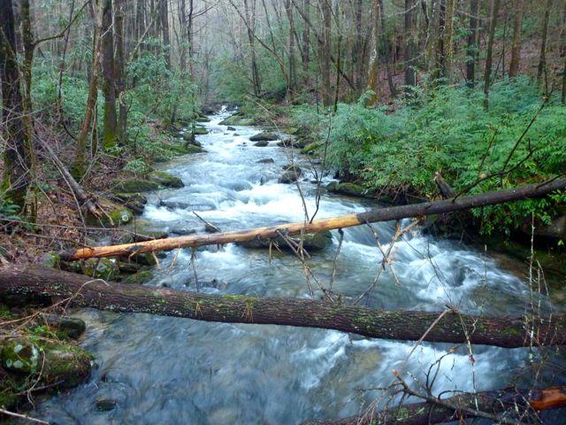
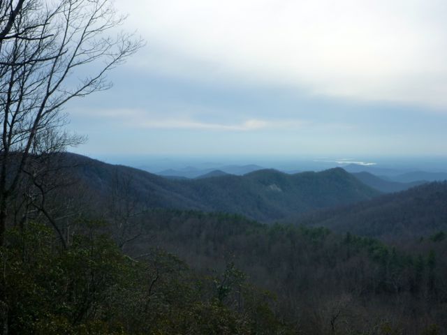
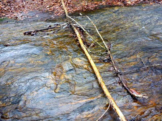
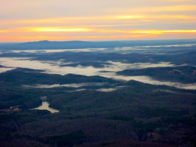
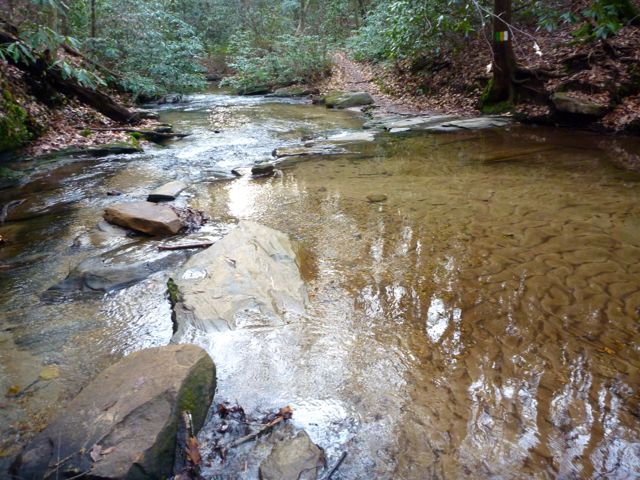
I tried to document interesting sights with photos and video but a lot of the views aree wide and grand or somewhat masked by trees and the photos and video don't really do the area justice. The trail is very scenic. There are some less-thrilling spots too of course, but over all, it's got a wide variety of terrain and environments and lots of water between the creeks, rivers, and waterfalls.
Travel time to Table Rock State Park near Pickens, South Carolina was about 7.5 hours from Yorktown, Virginia. I left at 4am and got checked in at the Table Rock State Park visitor center at about 11:30. There is a $2 a day parking fee. The trail itself is free to hike but I had to fill out a registration card and get a tag for my car with my expected return date. Rangers aren't allowed to leave the park if a car with a past-due tag is in the parking lot. I allowed an extra day for my hike in case I felt like lolly-gagging or had any issues with my knee and wanted to cut my planned daily mileage a bit. I had pre-arranged a shuttle ride to the other end of the trail at Oconee State Park thanks to the list of volunteer drivers on the Foothills Trail Conference websites. The shuttle driver was waiting for me as I drove into the Table Rock parking lot right at noon so I had zero seconds delay before I was back in a car to Oconee State Park about 40-50 miles away. (I gather it's courteous to tip the volunteer drivers about $1 a mile so that's what I did.) He's a retired shop teacher who lived in the area his whole life and use to work the trail.
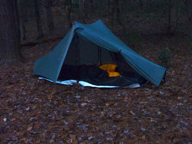
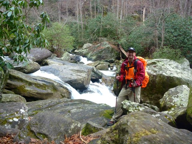
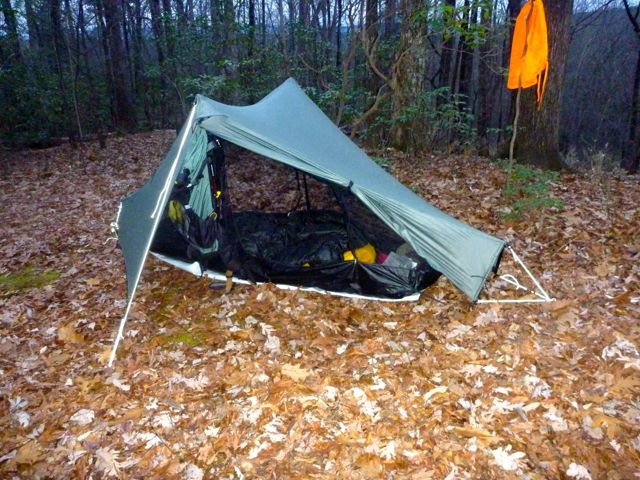
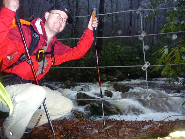
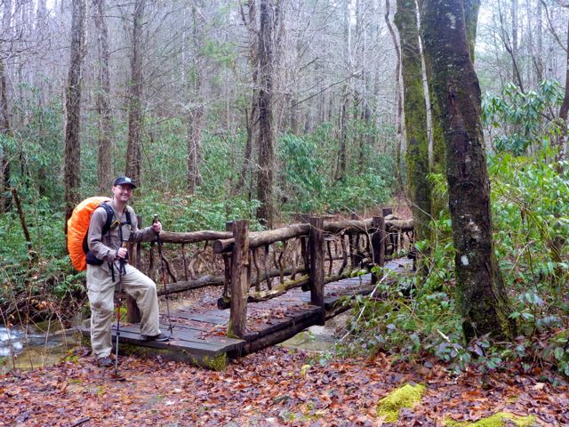
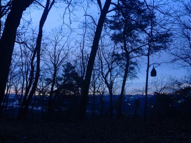
I hit the trail at 1pm exactly on Friday 27 December and hiked at a pretty good clip. I saw a couple day hikers and a pair of backpackers inbound to Oconee (pronounced Oh-Cone-ee). The trail hit the Chattooga River turns to follow it up stream. Georgia begins on the other side of the river. I found a lovely camp site right on the river around 4:50 pm just as the sun was sinking in the sky. It turns out a pair of tents were on the other side of a bushy barrier. I'm not sure they ever saw me. I certainly never heard them given the roar of the river. It was a bit chilly that night (probably in the mid 20's) but pretty humid in the valley next to the river. It turns out that's a recurring a theme on the Foothills Trail - low lying camping spots near water. I slept with my tent (a Tarptent Notch - weight: 26oz) flaps wide open, watched the stars and listened to the roar of the river as I drifted off. Daily mileage total was 11 miles and about 2600 feet of elevation gain (and 2600 feet of loss).

I awoke at about 6:30 am and packed up. There was some light condensation on the tent that had frozen. I wiped it off with a bandana before packing up. This became a morning routine. I was on the trail by about 7:30 and followed the Chattooga River for several miles before climbing out of the valley. I passed by nearly a dozen campsites of various sizes, about half of which had tents set up even at 10am. One site looked more like a longer term fishing camp. I imagine the guys were down there to fish the Chattooga for a few days. I think that'd be a lot of fun. There was some short but steeper climbs out of the valley (another theme).

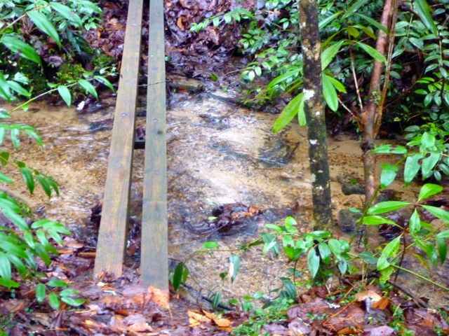
Water is everywhere. Little springs, creeks, and seeps abound. I never carried more than a liter of water and was never thirsty. I'd stop two or three times a day to filter/refill and maybe tank up my 2 liter water bladder for evening before I hit a camp in case a reliable source wasn't immediately present. I filtered water with a Sawyer mini filter, part of the new trend of water filters. It uses some sort of nano/micro tubes to physically filter out anything bigger than 0.1 microns. That eliminates any of the nasty bugs that might be found in the US (mainly Giardia and Cryptosporidium). It takes no batteries, has no moving parts, can be back-flushed if gets clogged up, and weighs 2 oz (and it's cheap at about $15). The only downsize is you can't let it freeze, but that's easy to avoid.

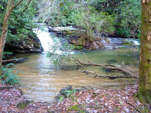
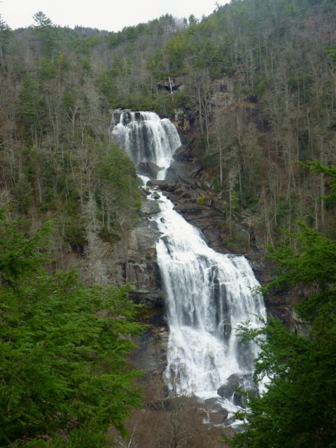
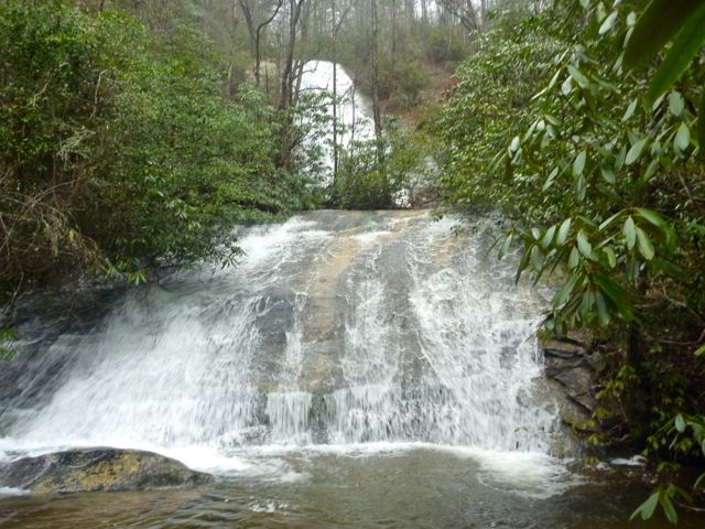
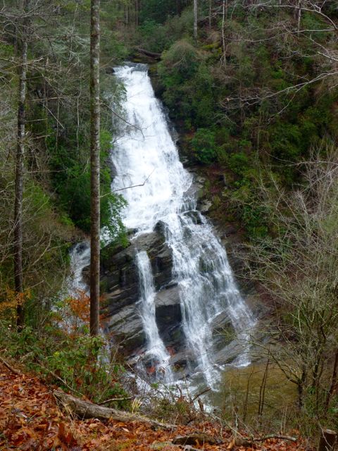
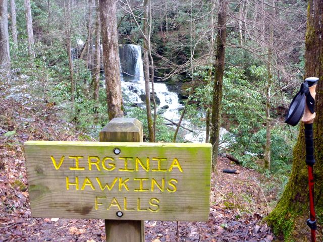
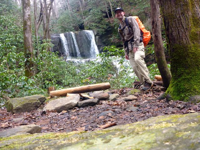
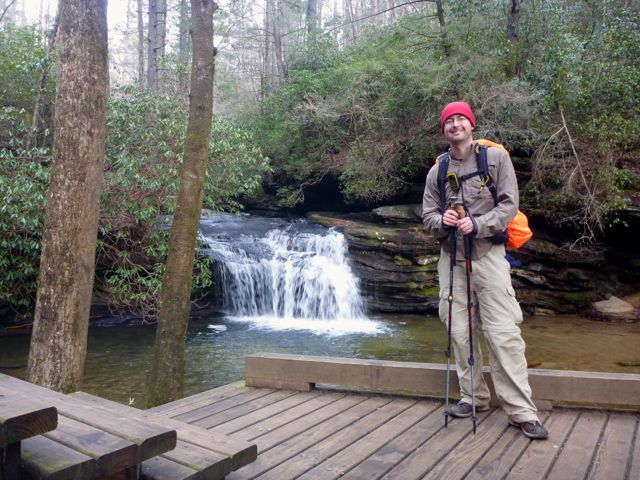
I got to see Upper Whitewater Falls which vies with Crabtree Falls in Virginia (which I've hiked a couple times) with tallest waterfall east of the Mississippi (according to Wikipedia). I have to say Upper Whitewater Falls is definitely more dramatic. And loud. Wow! I soaked that in for a while, and not just because I had to climb a bunch of steep steps to get to the overlook. I had brief chat with a young, local couple who had parked above and climbed down for the view.

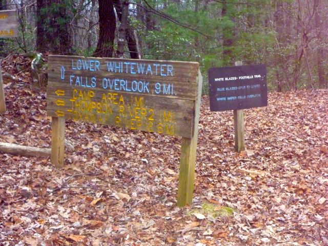
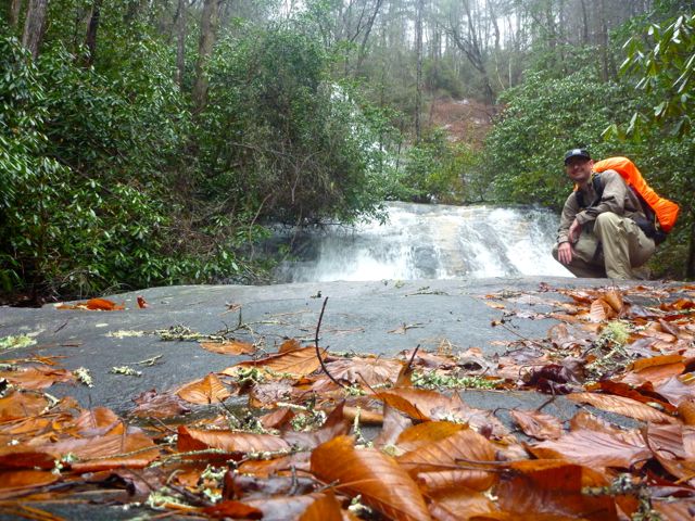
The descent along the Whitewater river was steep, wet, and slippery. I'm glad I wasn't climbing it. You drop fast then follow along the Whitewater river. This whole zone is "no camping" and pretty gorgeous the whole way. I finally hit the Bad Creek Access point which is where camping opens up again. Then I saw a sign for 1.7 miles to Lower Whitewater Falls and panicked since it was already 4:30 pm and growing dark. I hoofed it only to find the official camp site much sooner (in about a mile). I had incorrectly thought that the camping area was about a mile past Lower Whitewater Falls. I declined hiking the extra 0.9 mile (one way) to Lower Whitewater Falls due to growing darkness and the ominous rain drops starting to fall. I made camp at the large official camp site, walked down to the creek to fill up on water for the evening, and got dinner going as the rain picked up. As I sat listening to the rain drops hissing as they fall on the hot cooking pot, a trio of guys showed up and camped a bit down the hill near the creek. I crawled into the tent around 7pm and listened to the rain grow steadily stronger. The total for day two was 22 miles for day 2 and 5000 feet of elevation gain (and 4700 loss).
It rained all night, sometimes pretty heavily. I woke up around 6:30 am and hung out in the tent until about 7am when the rain seemed to stop. I got packed up and on the trail by about 7:45. I wore my hardshell for an hour or two (I finally bought a real hardshell after my disastrous rain experience at the Standing Stone Trail trip) but it wasn't really needed. I ended up wearing my fishing shirt the whole day - a thin, nylon button down shirt that dries out in about 10 minutes no matter how wet it is. I also highly value quick-drying after the aforementioned Standing Stone trip. I was moving fast enough I was plenty warm but I passed some boy scouts going the other way who were bundled up and looked at me like I was crazy.
I had my routine down by day three. In the morning I'd pack things up, fill my pockets with food for the day: pop-tart (cinnamon brown sugar), two snickers bars, home-made beef jerky, a bag of home-made trail mix, and a bag of dehydrated apples. I'd hike along until I got hungry and eat the pop-tart. Next came a snickers bar. The home-made beef jerky and trail mix were snacked on throughout the day. The apples and last snickers bar usually got eaten around 3pm. I'd have dinner around 5:30 or 6:00pm after setting up camp.
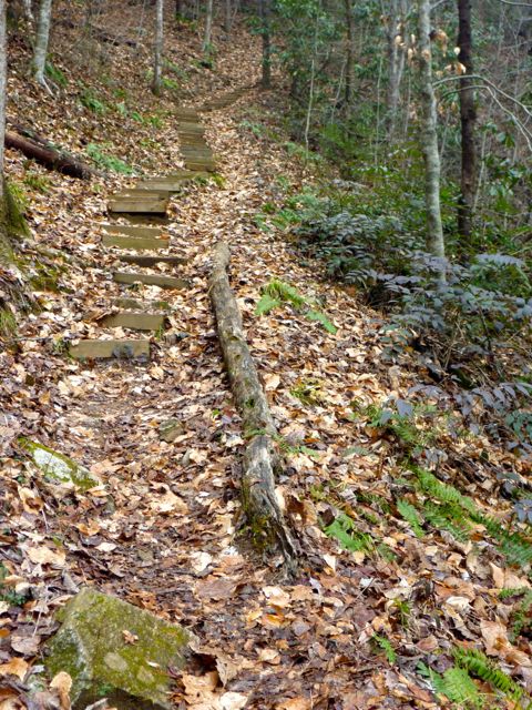
There was a fair bit of old logging road (feels like double-track trail - no gravel!). A wild turkey startled me by making a huge ruckus and flying off (slowly) down the valley as I got near it. It's odd to see a bird that big fly (oh, the humanity!)
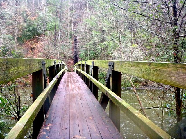
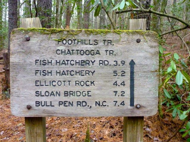
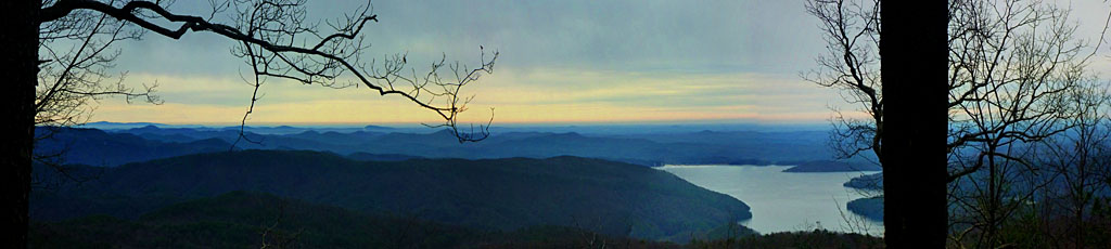
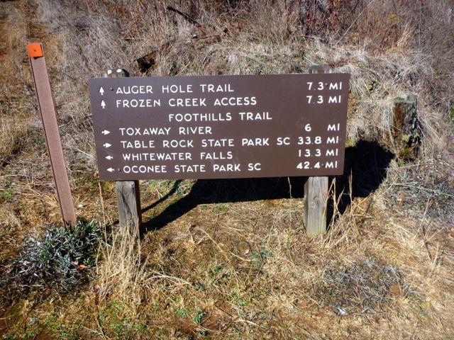
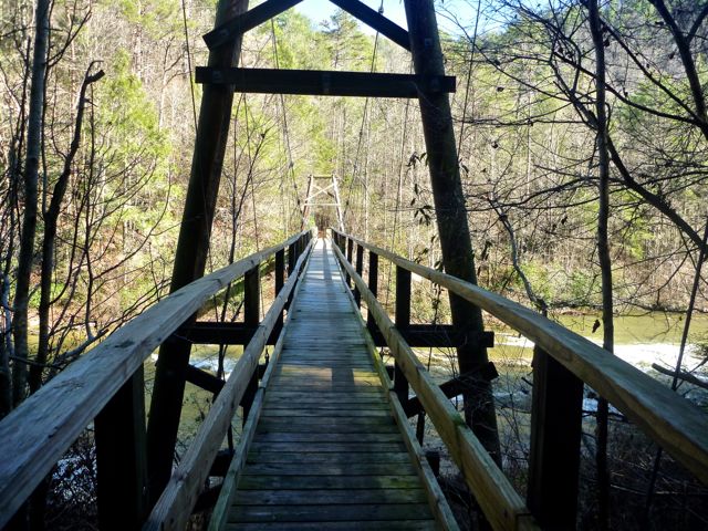
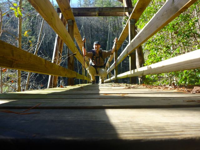
The trail descended down to one end of Lake Jocassee. There's an interesting trail access point here: the Canebrake access is for boats! There are no roads nearby. I never did see anyone out on the lake though I think it's a pretty hopping place in the summer. As you round the lake the trail crosses the Toxaway River on a large, bouncy suspension bridge. Based on Google Earth photos, the lake is quite high right now. The trail then crosses Toxaway Creek on a smaller, less bouncy suspension bridge. There's a trail head there that takes you up into North Carolina. From the map it looks like you could make a nice 20 mile bonus loop by taking the Auger Hole Trail and returning on the Canebrake Trail (or vice versa).
There is a large camp site (really a cluster of 6 campsites) just past the suspension bridges right along the lake shore. They have fire pits with metal grates and picnic tables and everything. There's a smaller site right on the water a bit further down that would have had a lovely sunset view across the lake, but I trekked on up and over Heartbreak Ridge (a short but brutal 45% grade per the Garmin!). I wanted that done with and there was a camp site on the other side. It took about 30-40 minutes for that one mile over the ridge. Folks I've hiked with know I'm not great on the "going up" part and this was no exception. I camped at the large camp site right next to Rock Creek. It was a bit damp and cool being sheltered from the sun most of the day but as good an option as any. It felt odd ending the day at 3:00 pm. It turns out the next camp site was about 5 miles ahead but pretty soggy so I had no regrets.
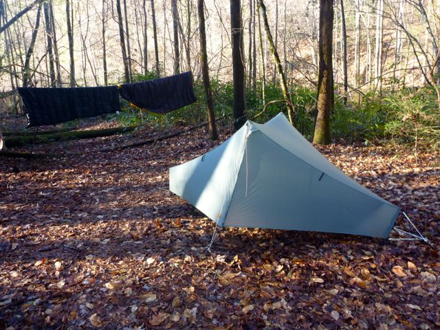

Given the rain the night before I hung my quilts up to air out while I made dinner. It turns out they were really quite dry and that wasn't necessary. I had planned on bringing just my new, home-made 30 degree down quilt. Due to some design errors on my part it's not quite warm enough for 30 degrees and the weather for the trip had shifted to several mid-20's nights anyway. To counter-act that I brought the 30 degree quilt and my 45 degree quilt and layered them. On the two warmer nights I just used the 30 degree quilt. On the two colder nights I lay the 45 degree quilt on top of the 30 and was toasty warm. Why quilts? When you lay atop your insulation (sleeping bag) it compresses the insulation and it loses it's effectiveness. A quilt just eliminates the "bottom" of the sleeping bag, eliminates the zipper, and is lighter over all. My quilts weight about 16-20oz each. Even with both it was lighter than my 15 degree sleeping bag. I had my Xtherm sleeping pad for beneath me. It's got a pretty high R-value and I tended to the "too warm" side of things vs the "too cold" which is fine by me.
The totals for day three were 18 miles with 4500 feet of gain and 5400 feet of loss. This was the first night on the trail with nobody near me. It was a new experience for me to be solo and "out there". It was comforting to have the creek nearby to sing me to sleep. Despite my concerns about wild life sneaking about and waking me up I heard and saw remarkably little wildlife. The only mammals I saw were some squirrels in the parking lot at the nature center. On the trail I only saw some birds. One set of hikers I passed said they saw a deer up on the ridge but I must have missed it. A couple folks I ran into lamented the lack of deer and bear to hunt. I gather the area is pretty hunted out now, unlike when they were kids. I always had my orange blaze cover on my pack since it was technically deer hunting season though I never saw a hunter nor heard any shots.
I got another later-than-planned start on day four. It was cold in the valley and hard to get out of the tent although once I got up it didn't feel all that cold. I also find I'm lazier when no one else is around. I don't feel accountable to/for anyone. Day four had a lot to see. I passed Laurel Fork Falls, another great waterfall. The creek heads down and also feeds Lake Jocassee. I spent some time traveling along Laurel Fork Creek, crossing back and forth a dozen times on a variety of foot bridges. At one point there were three bridges all within sight of another as they zig zagged back and forth across the creek. It was all very green even in December and quite damp. I can only imagine how green this place is in the spring and summer. The trail then started to climb up through Laurel Valley, which is also quite pretty.
I arrived at one of the trail access parking areas near route 178 and declined the 2.7 mile spur (one way) to the Eastatoe Gorge. It looked like it was all on paved road, which isn't how I imagined it. It turns out it was just a short road section then you drop down a trail. I'll try to visit that next time.
After crossing 178 I climbed up near Chimney Top, crossed another paved road, and continued climbing up to the tippy top of Sassafras Mountain, the highest point in South Carolina (at 3500 feet or so). There was some active logging going on and I had to cross a super muddy and very active logging road. I passed a pair of day hikers heading the opposite direction near here. Both of these sections were higher up on the ridge and the leaves had been dried from the sun so I was back to crunching happily along the trail as it wound about the foothills.
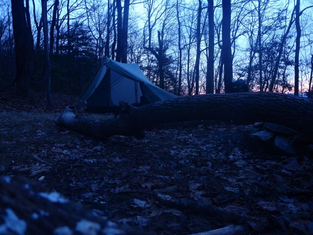
As I neared the peak of Sassafras a huge snowy owl flew by me, perched above me, glared at me skeptically, then flew off. Sweet! (Alas, it did not delivery any mail.) The views from Sassafras Mountain were pretty nice despite the haze in the air. The parking lot at the observation deck was deserted on a Monday afternoon. There is a trail head here that will take you to Caesar's Head State Park (about 13 miles away, vs Table Rock at about 11 miles away). It's an alternate path that stays on the North Carolina side of the border until diving back down in to South Carolina right as you hit Caesar's Head & Jones Gap State Park.
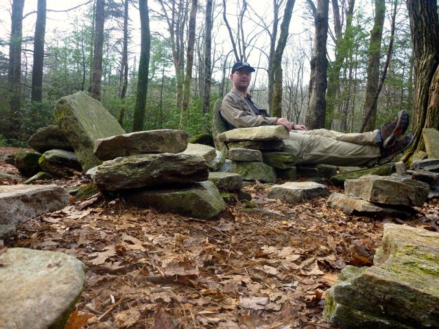
I forged ahead on the Foothills Trail with an "it's all downhill from here" attitude and quickly came to a brilliant camp site that is the old Cantrell Homestead. Folks have taken great pains over to the years to rearrange large stones into a series of fully functional stone lounge chairs around a fire pit. It's awesome and completely deserted on a Monday night in December! It'd be a really fun campsite for a group, and likely sees a lot of traffic since it's only a mile or so from the Sassafras overlooking parking area. It was only 3pm and about 9 miles to Table Rock State Park. There was another camp site in 4 miles so I continued on through the rhododendron tunnel hoping for a shorter day the morning of my long drive home.
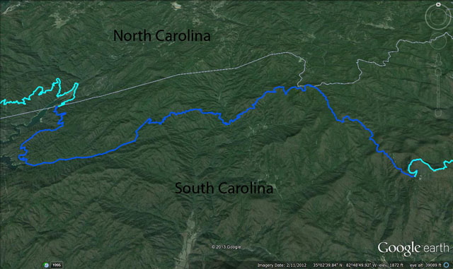
I hit the "camping spot" per the Garmin but didn't find much flat area to throw down a tent. I dropped my pack and scouted ahead and found a pretty small but sweet spot overlooking the valley. I ran back, grabbed the pack and headed to the overlook. It was about 4:30 pm and nearing sunset. I reviewed the guide book and decided (incorrectly) that the official spot was further ahead. In my attempt to read the coveted (to me) "5 mile away spot" I continued ahead up a bit of a climb. After a mile I hit an official "4 miles to go" sign. Bummer! There is no back country camping inside Table Rock State Park (the border of which is 4.5 miles on "to go" on the trail). I had to back track at least half a mile but given the climb and lack of flat spots I ended up going a full mile back to the previously identified sweet overlook spot. It felt a bit less sweet given the two bonus miles. It was also cooling off fast and now quite dark. I made my last dinner on the trail and watched all the city lights start to light up the valley (ok, it was pretty cool). Day four ended up being 23 miles (including the two bonus miles) and 6700 feet of gain (5200 loss).
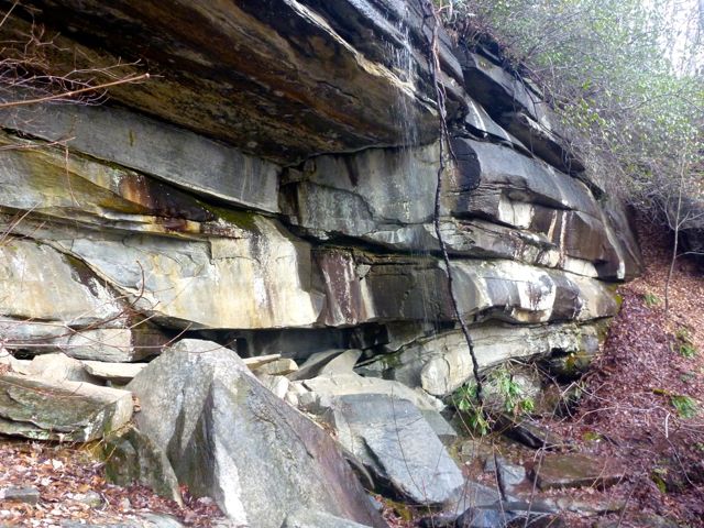
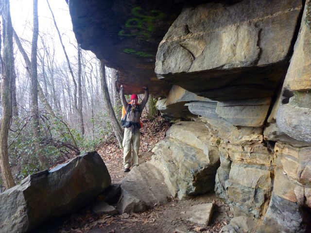
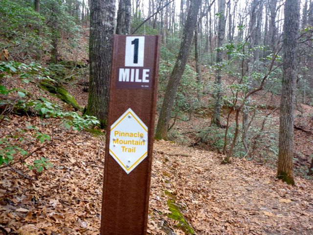
I awoke to my driest tent of the trip, despite it being buttoned down to block out the wind. It's nice being up on the ridge and not in a fog-filled valley. I was ready to go by 7am but watched the sunrise and fog flow through low spots below me and let the overcast sky lighten up some before I (re-)climbed the trail. The easy 4 mile descent coincides with the Pinnacle Mountain trail and took a while because there were a lot of really cool things to see. Rocky cliff overlooks, little waterfalls, fun rocky overhangs, slick rock creek crossing, etc. When the trail turned to black top and I started to see bundled up day hikers I knew I was close. That, and the Pinnacle Mountain trail was marked with signs every half-mile. I hit the Nature Center/Parking Lot at 9:30am officially finishing the Foothills Trail.
A quick change of clothes in the over-heated bathroom and I was back on the road by 10 am. As it turns out, the bathroom probably wasn't over heated but by now I was pretty comfortable in my nylon shirt, fleece hat, and no gloves, though the car thermometer said the air temp was 37 degrees. No wonder I got odd looks. It's funny how rapidly your body resets to what is comfortable. I checked in with the visitor center again to let them know I was off the trail. They were appreciative, but the fact that my car (and it's "back no later than" sign) was gone was sufficient. The last day was an easy 5 miles with 1000 feet of gain and 2500 loss.
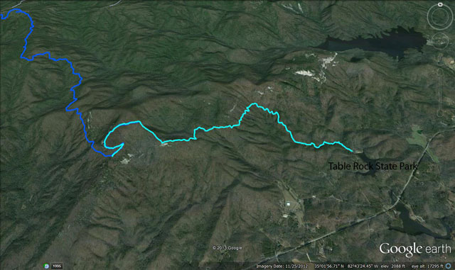
Over all I logged about 79 miles, give or take, and 20,000 feet gain (and 20,000 feet loss). Given how wet it was in December, I can only assume it can be a real bog in the spring, and probably brutally humid mid-summer. Maybe those cool valley camp site are more pleasant, though I can't imagine they're any drier. I tried to mark way points on the Garmin at each camp site I passed with their relative size (small, medium, large). Overall the trail was basically mine and mine alone. I saw maybe a dozen backpackers and only 4 were going in the same direction I was. A minor word of caution: the guide book is written for travel from Table Rock to Oconee -- opposite of the way I hiked. That made tracking features a little challenging at times. On the plus side, it kept the bigger climbs to where I was lugging along less food (and hence less weight).
I took my home made alcohol stove with me. It's a Fancy Feast cat food can with a fiberglass liner. I made a "caldera cone" to hold my pot and provide wind screen. It makes a very thermall efficient system, is cheap, and is extremely light weight. A bit less than one ounce of denatured alcohol will boil 2 cups of water in about 5 minutes. The stove burns out when it runs out of fuel and you're done. The whole thing weighs a couple ounces total, plus the weight of the fuel. I brought about 8 oz of fuel and used about 5-6oz. I usually boiled up 3-4 cups of water a night (since I was effectively making two meals each night). I didn't have a hot breakfast like I had planned so ended up lugging around close to a pound of oatmeal that I never ate. Lesson learned. When I hike with Kaylee we do a 'real' breakfast, but I don't find I want to when I go solo. It's also nicer to just get hiking on a cold morning. You warm up faster that way!
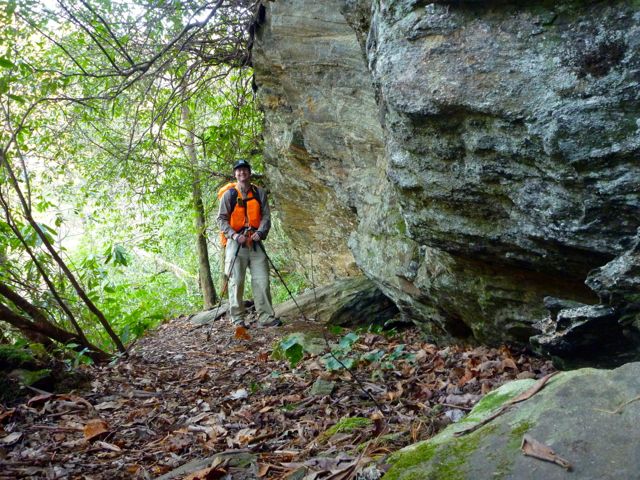
My starting pack weight with food, fuel, and 1 liter of water was about 27 pounds. I started with about 7 lbs of food; enough for my planned trip and one extra day. The rest of my pack including fuel and a liter of water was 20 lbs. It was definitely nicer hiking on the last day with about a 22lb pack vs day one with the full 27 lbs. That includes the camera, gps, maps, book, batteries, phone, and all that as well which I wouldn't have normally had. I think for a summer trip I can get that down to 15 lbs without food very easily.
I tried out a lot of home-dehydrated foods on this trip. In addition to the beef jerky, apples, sweet potato chips, and half of my trail mix, most of my suppers were home-made dehyrdrated meals. I had spaghetti with sauce one night (the sauce dehydrates to something that looks like a fruit roll up and is actually pretty tasty by itself), lentil soup with broccoli, mushrooms, and onions (rehydrates by the time you finish pouring hot water on it and find your spoon), and couscous with dehydrated vegetables (inflates to 10x it's packaged size!). They all turned out really nicely and I ate well and went to bed full. I also usually ate a package of ramen noodles each night as well.
Clothing wise I had two sets: one for hiking and one for sleeping. My hiking set consisted of two pair of socks, my REI Sahara pants (made out of a supplex nylon which is very light, dries super fast, and is pretty tough stuff), a wool base layer that I only wore on the first and last day, and my fishing shirt (I think made by Columbia but I debadged it because I found the labelling obnoxious). When I stopped for the day and set up the tent I changed out of my hiking shirt(s) and put on a grid-fleece hoody, fleece hat, and my down puffy jacket. When I crawled into the tent I'd lose the muddy pants and put on some polypro long underwear things and some thick smartwool socks. It was great being warm and dry no matter how wet I got during the day. I did have a backup pair of hiking socks that I used after the rainy day. Keeping my feet dry was all but impossible anyway and I find wet feet aren't much of an issue for me as long as I put on dry socks when I get to camp or go to bed. As long as I keep moving my feet don't get cold. I did apply Body Glide liberally to my feet every morning which acts as a bit of water-proofing and keeps them slick. I didn't get any blisters nor have any foot issues the whole time.
A 4 minute movie of some of the highlights (not in chronological order).